Wyndham – Overview & Things to See and Do
Overview:
Wyndham is really two towns about 5 km apart and linked by a sealed road that skirts the edge of the mudflats. The reason for the two towns is geographic. As the population near the port grew, there was not enough high ground to accommodate the extra people, so they settled at a point 5 kilometres inland from the port. This inland location is where most of the population now lives.
The burgeoning live-cattle trade with South-East Asia and the increased production from the nearby Ord River irrigation area will ensure Wyndham remains a viable and busy port.
The port of Wyndham still has much of the atmosphere of an old Kimberley town. Boabs line the main street and most of the action centres around the pub and the hardware store. It re- mains the port of the East Kimberley, just as Broome is for the West Kimberley. As Wyndham supplies come in, ore, cattle and produce go out.
History
Wyndham was declared a town site on 2 September 1886, as a result of the gold rush at Halls Creek. The first lots of land at the port sold with a reserve of £50 each. Early on the town serviced miners who came in for supplies and later, pastoralists brought cattle for shipment to other ports in Australia and South-East Asia. After the gold rush, the town languished until 1919 when the meat works opened. Until its closure in November 1985, the works provided a popular tourist attraction, large saltwater crocodiles waiting at the outflow of the abattoirs blood drain.
In World War II, Wyndham was bombed on only one occasion and suffered little damage. However, in a separate attack, the Koolama, a State Shipping Service vessel, was hit on its way out of Darwin and, disabled, made its way to Wyndham where it sank upside down near the wharf. It remains a signfficant hazard for every ship using the port.
Things to See and Do
Tourism in this region is based on exploring the surrounding landforms, rivers wetlands and natural attractions. Four wheel driving, fishing, bush walking, bird watching are popular past times..
Five Rivers Lookout. A spectacular view from this lookout and puts the town of Wyndham in perspective. Breathtaking sunsets can be viewed from this vantage point.
Australia’ Largest Boab Tree Called the ‘largest Boab tree in Captivity’ this is an enormous tree in the Three Mile Caravan park. The exact circumference is not know but is approximately 25 metres at it’s widest point.
Fishing: Fish for the famous barramundi are plentiful in King and Pentecost Rivers, or try your luck at a waterhole further inland.
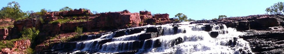
Grotto Swimming Hole An ideal swimming spot for all seasons which is at the base of a winding staircase of 140 steps. The water is crystal pure, even though at certain times the surface is marred by leaf mould. The grotto is washed annually with fast flowing waterfall during the months of the wet season. The grotto exudes a mystical atmosphere with the silence only interrupted by birdcalls and falling water.
Cockburn Range Where the sandstone bedding is almost horizontal, as in the Cockbum Range, the landscape Is dominated by flat-topped plateaus like those found in the mesa country of the south-west of the United States.
Kununurra – Wyndham 4WD Track A picturesque alternative to the main highway, this track takes 3 hrs and you will need to be very careful after wet because of the runoff along the wetland.
Parry Lagoons Nature Reserve: A protected bird sanctuary sheltering a number of species. The wetlands of Parry Lagoons Nature Reserve are an important feeding and breeding area for many local birds and a stopover point for migratory birds some from as far away as Siberia. Species such as magpie geese, swamp hens, cranes, pelicans, brolga, and ducks are common. The reserve is open during dry weather and has marked walk tracks. The reserve is regarded as a wetland of international significance.
Historic Sites such as the Old Halls Creek Road and the ruins of the Telegraph Hill are also found in the reserve. Old Halls Creek Road was built in 1894 and the stones that were painstakingly laid by hand to line the road edges can still be seen in places. This road is negotiable by 4WD vehicles only and may be impassable during the wet season. The main access road in the reserve leads to Telegraph Hill which is one of many basalt hills on the floodplain and has some historic ruins relating back to WW I and a wireless station built by naval intelligence. From here you can view the surrounding floodplain and distant hills.